3 and 1/2 miles round trip
Steep elevation gain - 900 ft.
Wear a hat and carry water, very little shade
Completed in 1 hour 50 minutes - made several stops, moderate pace.
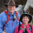
A cool, windy day with snow flurries coming in over Boulder Mountain and a significant amount of snowfall predicted for the following day; Annette and I took an afternoon break and headed out to explore a hiking trail in Capitol Reef National Park. We have driven past the Chimney Rock pinnacle numerous times and have wanted to hike the loop trail. The trail head parking area is a short distance off highway 24 (northside of hwy) and near the west border of the park; about 8 1/2 miles from Torrey (20 minutes from our house; Boulder Mtn., near Teasdale). Chimney Rock is near Panorama Point, the Goosenecks of Sulphur Creek, and Sunset Point - - all those are located close together and off the opposite side, south of route 24. Just to be sure that everyone understands, The Chimney Rock Trail does not actually take you up or out onto Chimney Rock! It does take you up nearby and above Chimney Rock.
 It was almost three oclock in the afternoon. The sky was overcast; winds were bringing in cooler air, dropping temperatures from the low fifties. Still, it was comfortable hiking weather when wearing a light jacket and hat. Even in this early Spring season, we carried plenty of water (about 1-quart each). There is a bathroom at the small parking lot; the parking area can only hold maybe 8 to 10 vehicles. Today we found the lot empty. Recommend being prepared for any unexpected weather changes, but we have found Fall, Winter, and Spring to be the best hiking seasons in this area.
 The first portion of the trail led us over the sand and gravel path to sweep out, curving to the northeast for about 1/4 mile before beginning a steep winding ascent. After climbing about 300 feet on the switchback path, we reached the plateau trail junction point for our loop path. We took the right fork (heading southeast) to continue our strenuous climb, knowing that our loop section would wrap around in a counterclockwise fashion to bring us back to this trail junction. Along the way we stopped at a few of the viewpoints to catch our breath and look back west towards Torrey and across to Boulder Mountain. We noticed the clouds and snow sometimes almost completely obscured our view of the mountain.
 Chimney Rock can be seen and photographed from the highway, the parking lot and the lower trail section, but some of the best views are just above the loop junction. Here about one-half hour into our hike, we can look down on the prominent spire that has eroded out off the side of the mesa. Chimney Rock stands 300 feet above the road, a pillar of red to chocolate brown Moenkopi sandstone layers topped by a light-colored Shinarump cap. The sandstone boulder cap is uranium rich and protects the softer levels of MoenKopi shale below it by slowing down the effects of erosion.
 Our counterclockwise path continued up and southeastward and soon lost sight of the Chimney as we made a steep climb over Mummy Cliff and onto the mesa top summit (6,634 feet elevation). We began to sense the allure of this popular park trail. It has the physical challenge of the steep, strenuous climb that is relatively short, plus allows close study of some of the rock strata common to this region (pdf document from the National Park Service), and provides numerous panoramic views that are stunning. Continuing across the mesa top (the larger Meeks Mesa is above and to the north), we neared completion of the first-third of our hike and sensed that there was a lot more to come. We also knew that we had already put the biggest elevation climb behind us. The rest should be a 'piece of cake' (we found that it was).
 Our walking path led us across the mesa top to an observation spot on the southeast corner. Here we took in the excellent views along the Waterpocket Fold, Hway 24 heading toward Fruita and further into Capitol Reef National Park. After a brief pause, we followed the trail as it dropped off the backside of the mesa and switched back to follow a plateau ridge on north eastward.
 The trail soon brought us to another fantastic viewpoint near the eastern limits of our hike. From this location near the half-way point, we can look out to the layered sandstone cliffs and observe several more of Capitol Reef's geologic features. Here we looked out on the colorful talus slopes with their muted shades of purple, grey and brown that are characteristic of the Chinle Formation.
  Above are the massive dark red vertical cliffs of the Wingate Formation that tower upwards for hundreds of feet in the sky. Our jaunt next took us north through a badlands stretch and the upper plateau drainage to then make a brief climb around a few eroded Moenkopi spires. Here we made another brief stop at another great viewpoint, then trekked around the corner to shortly intersect a trail junction for the Spring Canyon cross country route (Spring Canyon itself begins about a mile to the East). At this point, we know that we have walked about 2 1/4 miles from the trail head / parking lot.
 Now we are turned to the west and continuing through Chimney Rock Canyon for the return leg of our trip. We were walking over Chinle cobbles. Along the way, we noted the sparkle of numerous cracked gypsum crystals found in the terrain. At some locations on the trail, you can see parallel bands of gypsum embedded in Moenkopi shale layers. We also saw petrified wood chunks scattered near the trail. The path continued on to drop down even lower in a sandy wash and there in the banks, we saw several large trunk sections of petrified wood. The path through Chimney Rock Canyon soon brought us back to our first trailhead junction. From there, we made the steep descent down the Moenkopi shale incline and returned to the parking lot.
 This was a perfect hike for us. Great exercise, beautiful views, and varied formations like those towering Wingate cliffs found in many locations throughout Capitol Reef National Park. We will do this again; there is always a new viewpoint to examine, something you missed before, plants and wildlife to see. Next time, we should do the loop section in the opposite direction - - some people recommend this as the best approach. This is one of the most popular trails in the park and today we had it all to ourselves.
Note - The temperature continued to slowly drop. The following day, we received the largest snowfall of the year (winter season) at our home on Boulder Mountain. We measured 10 - 12 inches of the white stuff; much of it melted off our road by Sunday afternoon and we could travel out. We were snowed in for a brief spell, but it's likely that this trail was dry. It's usually ten degrees warmer in Capitol Reef than at our house.
Catch you next time, somewhere on down the trail . . .


No comments:
Post a Comment